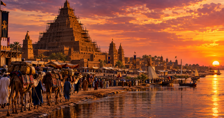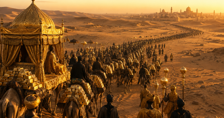
How a medieval African metropolis built a global trade empire in stone—and survived a century of colonial mythmaking.
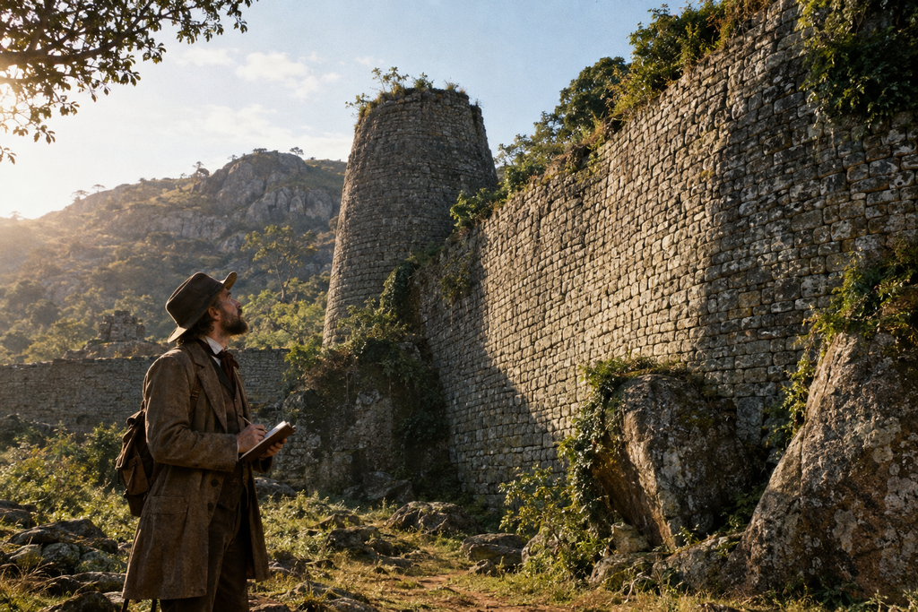
In the dry winter of 1871, a German-born explorer named Karl Mauch stood before colossal stone walls hidden among the granite hills of south-eastern Africa. Struck by the scale of the un-mortared masonry, Mauch refused to believe that indigenous Africans could have engineered such structures. Writing to European journals, he speculated that he had stumbled upon the lost palace of the Queen of Sheba, claiming the timber lintels within the stone were cedar imported from King Solomon’s Lebanon.
Mauch’s assertions were not merely a lapse in academic judgment; they became the cornerstone of a deliberate imperial myth. For the next century, first under Cecil Rhodes’s British South Africa Company and later under the white-minority regime of Rhodesia, colonial authorities systematically suppressed evidence pointing to an African origin. Rhodesian state censors went so far as to prohibit official archaeologists from publishing or broadcasting findings that proved native ancestors had built the complex.
The physical reality of Great Zimbabwe contradicts every layer of that colonial fable. Spanning nearly 722 hectares in the hills near modern-day Masvingo, the city was the capital of the Kingdom of Zimbabwe during the Late Iron Age, flourishing between 1100 and 1450 CE. At its peak, it housed an estimated 10,000 to 20,000 residents, making it the largest pre-colonial urban center in sub-Saharan Africa outside the Nile Valley. Built by ancestors of the Shona people—principally the Ancestral Shona and Karanga groups—the metropolis commanded a vast economic network that transformed local pastoral wealth into an empire of international trade.
The Limpopo Shift and the Roots of Statehood
Great Zimbabwe was not an isolated architectural anomaly. It was the natural evolution of an indigenous state-building tradition that had been developing across the Limpopo-Zambezi basin for centuries. During the early first millennium CE, Bantu-speaking agro-pastoralists migrated into the region, bringing sophisticated ironworking technology, cereal agriculture, and cattle husbandry. By 900 CE, social stratification began to accelerate in the middle Limpopo Valley.
The key precursor to Great Zimbabwe was Mapungubwe, an influential kingdom that flourished near the confluence of the Shashe and Limpopo rivers between 1075 and 1220 CE. Mapungubwe pioneered two fundamental structural changes that would define southern African urbanism. First, its rulers introduced the spatial segregation of elite power, moving their royal residences to the flat tops of inaccessible sandstone cliffs while the common population lived on the plains below. Second, they organized systematic long-distance trade, exchanging local ivory and animal skins for glass beads arriving from India and Egypt.
Around 1220 CE, the climate in the Limpopo Valley shifted toward drier conditions, degrading the flood-basin agriculture that sustained Mapungubwe’s population. As Mapungubwe declined, the center of political and economic gravity moved north to the high, well-watered granite plateau of modern-day Zimbabwe. Situated at a strategic ecological junction between the gold-bearing interior and the coastal trade networks, Great Zimbabwe inherited and expanded the political architecture of its predecessor.
Engineering in Granite
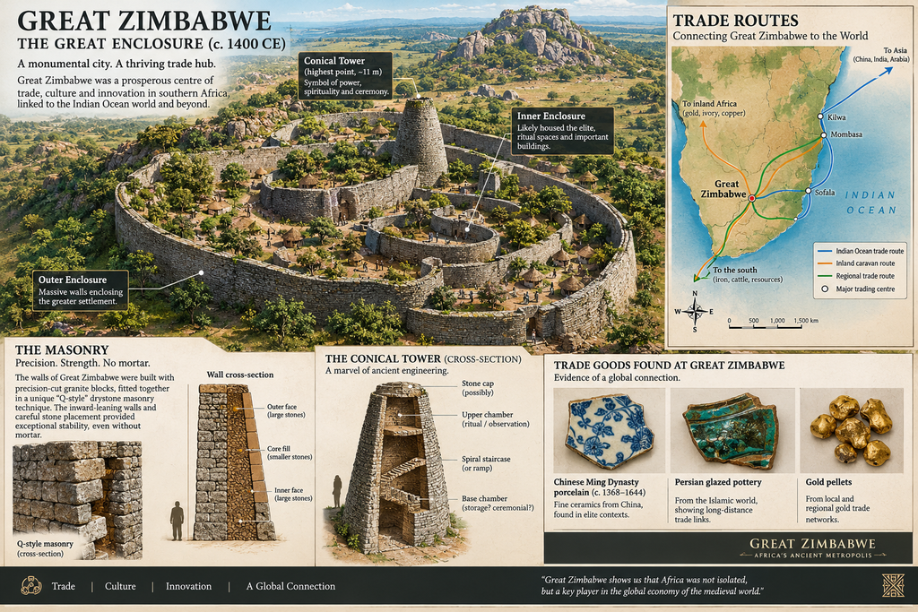
The defining physical feature of Great Zimbabwe is its extraordinary drystone masonry. The city’s builders constructed massive perimeter walls, narrow corridors, and towering platforms entirely without mortar, using local granite that naturally exfoliated into clean, flat slabs under alternating daily heat and night cooling.
Archaeologist Anthony Whitty identified four distinct masonry styles that chart the city’s technological evolution over three centuries:
P-Style: The earliest phase, characterized by irregular granite blocks stacked in uneven courses that follow the natural contours of the bedrock.
PQ-Style: A transitional style featuring partially dressed blocks with improving horizontal alignment.
Q-Style: The pinnacle of local masonry, defined by uniform, rectangular granite blocks meticulously dressed and laid in regular horizontal courses.
R-Style: A later, less structured style consisting of uncut stones stacked without distinct coursing, often used for late repairs or peripheral enclosures.
The site itself is divided into three primary architectural zones, each serving distinct political, residential, and ritual functions. High above the valley floor sits the Hill Complex, the oldest section of the city. Perched on a steep granite cliff rising 80 meters, this stronghold seamlessly integrates massive natural boulders into built stone walls to create narrow passageways, sacred enclosures, and royal living quarters.
In the valley below lies the Great Enclosure, the largest single pre-colonial structure in sub-Saharan Africa. Its outer perimeter wall measures over 250 meters in circumference, reaches heights of up to 11 meters, and contains an estimated 15,000 metric tons of granite blocks—all laid without a single drop of mortar. Within its interior stands the Conical Tower, a solid stone structure rising 10 meters high with a base diameter of 5 meters. Because it contains no internal chambers, entrances, or stairways, archaeologists reject early theories that it was a defensive turret or tomb. Instead, it is understood as a symbolic stone grain bin, representing royal authority, agricultural abundance, and the king’s capacity to redistribute wealth to his people.
Surrounding the Great Enclosure are the Valley Ruins, a series of stone-walled compounds that served as elite residential hubs, craft workshops, and administrative quarters for nobility and secondary lineage heads.
The Economic Engine and the Swahili Trade Nexus
While the massive stone walls projected authority, the true foundation of Great Zimbabwe’s power was a balanced economy that combined local pastoralism with global trade connections.
Cattle were the primary domestic store of wealth and political power. In Shona society, large herds provided high-protein sustenance, established social standing, and enabled political clientage through loaning systems. The surrounding savanna offered ideal seasonal grazing grounds, allowing the state to maintain thousands of head of livestock.
Complementing this agricultural base was an advanced metallurgical industry. Local smiths mastered the extraction and working of three crucial metals:
Iron: Essential for agricultural hoes, axes, and weapons that sustained domestic productivity and military defense.
Copper: Cast into ceremonial wire, armlets, and cross-shaped ingots that circulated as currency and symbols of rank.
Gold: Mined from reef deposits and panned from riverbeds throughout the plateau, then refined in specialized crucibles for export.
Great Zimbabwe functioned as the regional engine for the Indian Ocean maritime trade network. Local traders transported gold, ivory, copper, and hides down major river valleys to Swahili coastal ports such as Sofala in modern Mozambique. In return, the capital received luxury goods from across the globe. Excavations at the site have unearthed Chinese Ming dynasty celadon and porcelain, Persian glazed earthenware, Arab glassware, and millions of glass beads originating from India.
The Century of Revision and Scientific Discovery

The recovery of Great Zimbabwe’s true history required decades of systematic archaeological work to undo the damage wrought by early treasure hunters and imperial ideologues.
Following Karl Mauch’s sensationalized accounts, Cecil Rhodes established the Ancient Ruins Company in 1895, granting commercial concessions to mine ancient stone enclosures for gold. Between 1895 and 1900, mercenary treasure hunters led by Richard Nicklin Hall systematically looted the ruins. Hall stripped up to two meters of stratified archaeological layers from the Great Enclosure, destroying centuries of organic material, floor levels, and ceramics to retrieve gold artifacts, all while publishing texts insisting the site was built by Middle Eastern civilizations.
Scientific correction began in 1905, when Egyptologist David Randall-MacIver conducted the first systematic excavation. By analyzing imported ceramic fragments embedded beneath original plaster floors, MacIver proved conclusively that the site was medieval in date and built by indigenous African populations. In 1929, archaeologist Gertrude Caton-Thompson solidified this conclusion through precise stratigraphic excavation in the Hill Complex. Her landmark 1931 study, The Zimbabwe Culture, established that every aspect of the material culture—from pottery types to metalwork—demonstrated direct continuity with modern Shona societies.
Despite this overwhelming evidence, the white-minority government of Rhodesia enforced strict state censorship from 1965 to 1979. Museum guidebooks, radio broadcasts, and school curricula were mandated to describe the site’s origin as an “unsolved mystery.” Prominent archaeologists who publicly defended the scientific consensus, such as Peter Garlake, were forced into exile. When the nation achieved independence in 1980, it adopted its name directly from the Shona term for these stone monuments—Dzimba-dza-mabwe, meaning “houses of stone”—placing the site at the center of its national identity.
Sacred Birds and Shifting Power
In recent decades, scholars have moved beyond early structuralist models of the site to develop a dynamic understanding of how political authority operated within the city.
Early interpretations proposed that spatial organization was governed by a rigid cosmology, with a sacred king living isolated on the Hill Complex while commoners occupied the valley below. However, recent research led by African scholars like Shadreck Chirikure and Innocent Pikirayi demonstrates that power was mobile and dynamic. Radiocarbon dating and architectural analysis reveal that different enclosures in the valley and hill were constructed sequentially by successive rulers across generations. Rather than a static court, the city functioned as a multi-centric political landscape where power shifted between royal houses over time.
Central to the ritual authority of these rulers were eight carved soapstone birds recovered from the site. Standing roughly 40 centimeters tall atop meter-high pillars, these sculptures blend avian features—such as hooked beaks and broad wings—with human limbs and five-toed feet. In Shona cosmology, birds of prey like the bateleur eagle served as divine messengers. Placed within sacred enclosures, these sculptures functioned as physical conduits between the living king, royal ancestor spirits, and the supreme deity. Today, the stylized image of the Soapstone Bird remains the central national emblem of Zimbabwe.
Ecological Decline and Legacy
By 1450 CE, Great Zimbabwe’s long period of dominance was drawing to a close, and by 1500 CE, the metropolis was largely abandoned. The city’s decline was not caused by catastrophic invasion, but by environmental strain and shifting economic routes.
Centuries of concentrating up to 20,000 residents in a single valley exceeded the ecological carrying capacity of the land. Surrounding timber resources were exhausted for fuel and building materials, local grazing grounds were degraded by continuous livestock management, and soil fertility declined. Concurrently, regional gold trade routes migrated north toward the Zambezi River and west toward the Kalahari margin.
As the central authority fragmented, two successor states emerged: the Mutapa Empire in the north, which established direct trade relations with Portuguese merchants in the 16th century, and the Torwa Kingdom in the west, which constructed the terraced stone city of Khami.
Great Zimbabwe stands as proof of the engineering ingenuity, economic integration, and political complexity of medieval southern Africa. Built without mortar, its granite walls survived centuries of environmental change and decades of colonial revisionism, remaining a lasting testament to the civilization that built them.